Are you fed up with the constant battle of navigating unfamiliar terrain or feeling lost in the urban jungle? Enter Google Maps, your dependable digital guide through the maze of the modern world. Within these digital pages, we embark on a journey to uncover essential insights and expert tricks that will revolutionize your Google Maps experience.
Whether you’re a seasoned wayfarer or just setting foot in the realm of navigation apps, this all-encompassing handbook is your ticket to unleashing the full potential of this dynamic tool. Bid farewell to disorientation and usher in a new era of seamless navigation with Google Maps!
Contents
Google Maps Basic Navigation
Zoom In and Out
One of the most fundamental features of Google Maps is the ability to zoom in and out of the map. You can easily zoom in to get a closer look at a specific area or zoom out to get a broader view of your surroundings. To zoom in, simply double-tap on the screen or use the two-finger pinch gesture to zoom in and out. This feature is particularly useful when you need to examine a particular location or navigate through unfamiliar territory.
Rotate the Map
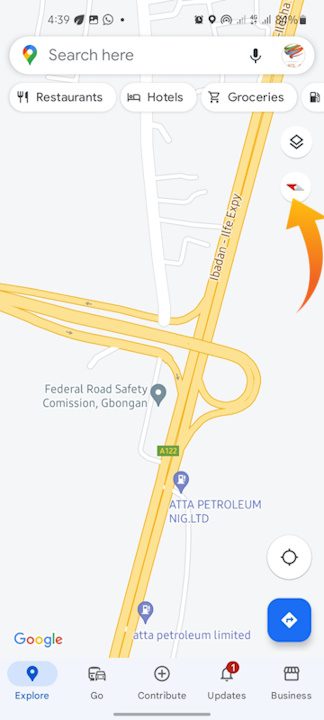
The ability to rotate the map is another useful navigation tool in Google Maps. You can change the viewpoint and get a better idea of the direction you’re facing by rotating the map. To rotate the map, twist two fingers in a clockwise or counterclockwise circular motion. This is especially beneficial when attempting to orient yourself in a new city or touring an area with intricate streets or landmarks.
Tilt the Map
Google Maps allows you to tilt the map in addition to zooming and rotating it. Tilted view lets you see the ground and buildings in 3D, providing a more immersive experience. Place two fingers on the screen and swipe up or down to tilt the map. This tool is very useful when you want to see the landscape or determine the elevation of a location.
Display Your Location
Google Maps has a nice function that displays your current location on the map. This is especially beneficial if you’re in an unknown region and need to find your way around quickly. Simply touch on the blue dot that symbolizes your current position to reveal your location. The map will be centered on your position, with a pulsing blue circle indicating your approximate radius. You can securely get to your preferred destination if you know your exact position.
Get Directions
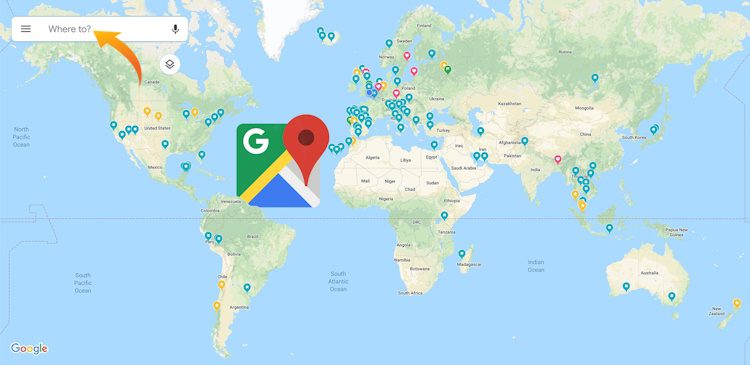
One of the primary purposes of Google Maps is to provide directions from one place to another. To get directions, tap on the search bar at the top of the screen and enter your starting point and destination. Google Maps will then provide you with a variety of route options, including driving, walking, biking, or public transportation. You can choose the route that best suits your needs and preferences. Additionally, you can specify additional parameters such as avoiding tolls, highways, or ferries. Google Maps will then display step-by-step directions, making it easy for you to reach your destination.
Save and Share Locations
To make it easier to find and revisit your favorite places, Google Maps allows you to save and share locations. When you find an interesting place or a spot you’d like to visit in the future, simply tap on the place’s name or pin, and then tap on the “Save” icon. You can save it to a predefined list such as “Favorites” or create a new list. This way, you can easily access the saved locations later, even when you’re offline. Moreover, you can share the saved location with your friends and family. This feature is especially handy when you want to recommend a restaurant, park, or any other point of interest.
Recommended: How to use Google Find My Device to Track Down your Lost Android Phone or Tablet or Wear OS watch
Exploring Places
Search for Places
Google Maps is an excellent tool for discovering new places, whether you’re looking for a restaurant, hotel, or tourist attraction. To search for places, simply tap on the search bar at the top of the screen and enter the name or category of the place you’re interested in. Google Maps will then display a list of relevant results based on your search query. You can further refine your search by specifying additional parameters such as opening hours, price range, or user ratings.
Get Place Details
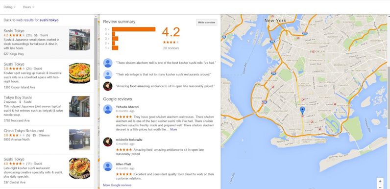
When you find a place of interest on Google Maps, you can access detailed information about that place. This includes the address, phone number, website, photos, reviews, and even popular times if applicable. Simply tap on the place’s name or pin to view its details. This feature allows you to gather useful information about a place before visiting it, ensuring that it meets your expectations and preferences.
Find Nearby Places
If you’re exploring a specific area and want to find nearby points of interest, Google Maps can help. By using the “Explore” feature, you can easily discover restaurants, cafes, parks, museums, and other attractions that are located nearby. Simply tap on the “Explore” icon at the bottom right of the screen and Google Maps will display a variety of categories for you to choose from. By selecting a category, you can see a list of relevant places in the vicinity, making it easy to find something new and exciting to explore.
Filter Search Results
To refine your search results and find exactly what you’re looking for, Google Maps allows you to apply filters. When searching, tap on the “Filter” icon at the top right of the screen. From there, you can specify parameters such as opening hours, ratings, price range, and more. This feature is particularly helpful when you have specific requirements or preferences for the places you want to visit.
Explore Street View
For a more immersive experience, Google Maps offers Street View, which provides 360-degree panoramic views at ground level. Street View allows you to virtually explore the streets and surroundings of a location, giving you a better understanding of what to expect before you arrive. To access Street View, simply drop a pin on the map tap on the place’s name, and then tap on the thumbnail image of the location. You can then navigate through the Street View imagery by swiping or tapping the navigation arrows.
Personalizing Maps
Create Custom Maps
To make your Google Maps experience even more personalized, you can create custom maps. Custom maps allow you to mark specific locations and add personalized notes, making it easy to create your travel itinerary or highlight places of interest. To create a custom map, tap on the menu icon at the top left of the screen, then select “Your places” and go to the “Maps” tab. From there, you can create a new map and start adding your markers and notes.
Add Labels and Pins
When creating custom maps or simply saving your favorite places, you can add labels and pins to make them easier to identify. By adding labels, you can provide additional information about a place, such as a description or a reminder of why it’s significant to you. You can also add custom pins to differentiate between different types of places or to create your visual categorization. This feature is especially useful when you have a large number of saved locations and want to quickly find a specific place.
Measure Distance
If you need to measure the distance between two points on a map, Google Maps has a handy distance measurement tool. To access this feature, long-press on the map at the starting point of your measurement, then tap on the “Measure distance” option. From there, you can place additional points on the map and Google Maps will display the total distance between them. This tool can be particularly useful when planning a hike, measuring the distance of a running route, or simply exploring the size of an area.
Save Maps for Offline Use
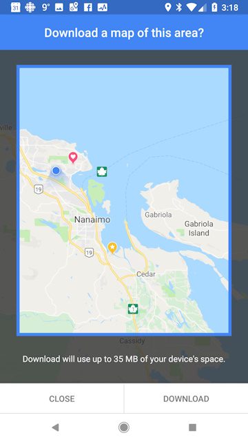
One of the most useful features of Google Maps is the ability to save maps for offline use. This is especially handy when traveling to areas with limited or no internet connectivity. To save a map for offline use, simply search for a location or an area, then tap on the place’s name or pin. From there, tap on the three-dot menu icon, and select “Download offline map.” Google Maps will download the map data for that area, allowing you to access it even when you’re offline. This feature ensures that you can navigate and explore even when there’s no internet connection available.
Saving Favorites
Save Places as Favorites
When you discover a place, you love or want quick access to, you can easily save it as a favorite. To save a place as a favorite, tap on the place’s name or pin to view its details, then tap on the “Save” icon. You can choose to save it to a predefined list such as “Favorites” or create your personalized list. By saving places as favorites, you can easily access them later and quickly navigate to your preferred locations.
Add and Manage Lists
In addition to saving individual places as favorites, Google Maps allows you to create and manage lists. Lists are a convenient way to organize your favorite places or create themed collections. To create a list, tap on the menu icon at the top left of the screen, select “Your places,” and go to the “Saved” tab. From there, tap on “Create new list” and give it a name. You can then add places to your list by tapping on the place’s name or pin and selecting the list you want to add it to. This feature makes it easy to categorize your favorite places and keep them organized for future reference.
Access Your Saved Places
Once you’ve saved places as favorites or added them to lists, you can easily access and view them on Google Maps. To view your saved places, tap on the menu icon at the top left of the screen, select “Your places,” and go to the “Saved” tab. From there, you can see all your saved places, organized by list if applicable. This allows you to quickly access your favorite locations, making it effortless to plan your daily activities or share recommendations with others.
Planning Trips
Plan a Multi-Stop Route
When you need to plan a trip with multiple stops, Google Maps offers a convenient feature to help you optimize your route. To plan a multi-stop route, tap on the menu icon at the top left of the screen, select “Your places,” and go to the “Maps” tab. From there, create a custom map and start adding your desired stops. Google Maps will then calculate the most efficient route, taking into account traffic conditions and the order of your stops. This feature is particularly useful when you’re going on a road trip or need to visit multiple locations in a specific order.
Avoid Tolls and Highways
If you prefer to avoid toll roads or highways when navigating, Google Maps allows you to customize your route preferences. When you search for directions, tap on the three-dot menu icon at the top right of the screen, then select “Route options.” From there, you can choose to avoid tolls or highways, depending on your preferences. Google Maps will then provide you with an alternative route that avoids the selected elements. This feature is especially handy when you want to take a scenic drive or if you have specific driving preferences.
Add Multiple Destinations
In addition to planning a multi-stop route, you can also add multiple destinations to your route. When getting directions, tap on the three-dot menu icon at the top right of the screen, then select “Add stop.” You can then enter the desired destinations in the order you want to visit them. Google Maps will automatically recalculate the route to include all your stops. This feature is particularly useful when you need to make several quick stops on your way to a final destination, such as running errands or sightseeing in a new city.
Find Gas Stations and Rest Stops
When you’re going on a long road trip and need to find gas stations or rest stops, Google Maps can assist you in locating these essential amenities. Simply search for “gas stations” or “rest stops” along your route, and Google Maps will display a list of nearby options. You can then choose the most convenient option based on the distance, ratings, or other factors. This feature ensures that you can plan your stops efficiently and avoid running out of fuel or feeling fatigued during your journey.
Check Traffic Conditions
To help you navigate through traffic and avoid delays, Google Maps provides real-time traffic information. When you’re planning your route or driving, simply check the traffic layer on the map to see current traffic conditions. Google Maps uses various data sources to provide accurate and up-to-date traffic information, including congestion, accidents, and road closures. This feature allows you to plan your trips effectively, choose the fastest route, and avoid unnecessary delays.
Discovering Local Guides
Join the Local Guides Program
If you enjoy exploring new places and sharing your experiences, you may want to consider joining the Local Guides program. Local Guides are individuals who contribute valuable information, reviews, and photos to Google Maps, helping other users make informed decisions about places they might visit. By becoming a Local Guide, you can earn points, level up, and unlock exclusive benefits and rewards. Additionally, you can join a community of like-minded individuals who share a passion for discovering and sharing their knowledge of various locations around the world.
Write Reviews and Share Photos
As a Local Guide, one of the main ways to contribute to Google Maps is by writing reviews and sharing photos. When you visit a place, you can provide your feedback, ratings, and personal insights about the establishment. This information helps other users make informed decisions and ensures that the information on Google Maps remains accurate and up to date. Additionally, by sharing photos, you can showcase the ambiance, features, and highlights of a place, giving potential visitors a visual preview and enhancing their overall experience.
Level Up and Earn Rewards
As you contribute more to the Local Guides program, you can level up and earn various rewards and benefits. The more points you accumulate through your contributions, the higher your level will be. Each level comes with its perks, such as early access to new Google features, special events, and exclusive content. By leveling up, you not only gain recognition for your contributions but also gain access to additional resources and opportunities to further enhance your knowledge and skills as a Local Guide.
Using Indoor Maps
Navigate Inside Buildings
Google Maps not only helps you navigate outdoor areas but also provides indoor maps for select buildings. These indoor maps allow you to easily find your way around large complexes such as airports, shopping malls, or convention centers. Once you’re inside a supported building, simply zoom in on the map to see the indoor layout. You can then locate specific areas such as gates, shops, restaurants, restrooms, or elevators. This feature is particularly useful when you need to navigate through a complex building or find a specific store or facility within it.
Find Stores and Amenities
When you’re in an unfamiliar building or complex, Google Maps can help you find specific stores and amenities. By using indoor maps, you can easily locate shops, restaurants, restrooms, and other facilities within a building. Simply search for a specific store or category, and Google Maps will highlight the relevant locations on the indoor map. This feature is especially handy when you’re shopping or exploring a large mall or department store and want to quickly find a particular shop or service.
Use Indoor Maps to Plan Shopping
In addition to helping you navigate inside buildings, Google Maps’ indoor maps can also be a valuable tool for planning your shopping trips. By viewing the indoor layout of a shopping mall or retail complex, you can easily identify the stores you want to visit and plan an efficient route. You can also check for additional information about stores such as opening hours, phone numbers, and reviews. This feature allows you to make the most of your shopping experience and ensures that you don’t miss out on any must-visit stores.
Exploring Street Art
Discover Street Art Around the World
If you appreciate street art and want to explore vibrant and unique artworks, Google Maps can guide you to various locations around the world. By using the “Street Art” layer, you can see where street art is located and plan your street art tours. Simply tap on the “Layers” button at the top right of the screen and select the “Street Art” layer. Google Maps will then display icons indicating the locations of notable street art. By tapping on these icons, you can learn more about the artwork and the artists behind them.
Find Info about Street Artworks
Beyond simply discovering street art, Google Maps provides valuable information about the artworks themselves. By tapping on the icons representing street art, you can view detailed descriptions, photos, and even links to additional resources. This gives you insight into the inspiration, cultural significance, and history of the artworks, enriching your experience as you explore street art around the world. Whether you’re an art enthusiast or simply curious about the street art scene, this feature allows you to delve deeper into the stories behind the creative works.
Using Live View
Enable Live View
Live View is a feature in Google Maps that utilizes augmented reality (AR) to enhance your navigation experience. It allows you to see real-time directions and visual overlays on the live camera feed of your smartphone. To enable Live View, start by selecting your desired destination and getting directions. Then tap on the “Start AR” button and follow the on-screen instructions to calibrate your device. Once activated, you can point your camera at the surroundings, and Google Maps will superimpose directional arrows onto the real-world view, guiding you to your destination. This feature is particularly helpful when you’re navigating in complex or unfamiliar environments.
Navigate with Augmented Reality
With Live View, you can navigate with augmented reality, making it easier to understand and follow directions. As you walk, you’ll see arrows and indicators overlaid on the real-time camera feed, pointing you in the right direction. These indicators will dynamically adjust to match your movements and ensure that you stay on the correct path. By using augmented reality, Live View provides a more intuitive and immersive navigation experience, especially in densely populated areas or crowded city streets.
Use Live View with Public Transit
Live View also extends its functionality to public transit systems, making it easier to navigate through stations and find your way to the right platform. When you’re using public transit directions in Google Maps, you can enable Live View to see virtual signs, arrows, and other visual cues overlaid on the camera feed. This feature helps you navigate complex transit networks, find your platform or bus stop, and ensure that you’re heading in the right direction. By combining augmented reality with public transit information, Live View offers a seamless and intuitive way to navigate through unfamiliar transportation systems.
Utilizing Google Earth
View Earth in 3D
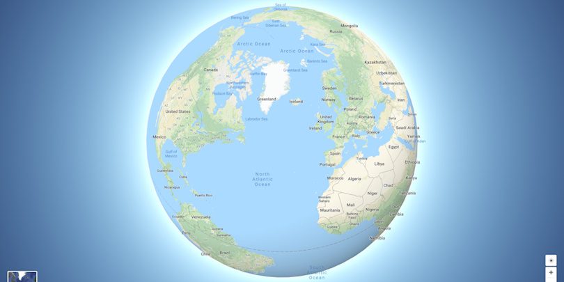
In addition to Google Maps, Google Earth is another powerful tool that allows you to explore our planet in incredible detail. Google Earth provides a 3D representation of the Earth, complete with detailed aerial imagery, 3D buildings, and terrain. You can zoom in and out to view specific locations, rotate the globe to explore different regions and tilt the view to see the terrain in an immersive 3D perspective. Google Earth offers a unique way to explore our world from a satellite’s perspective and gain a deeper understanding of its geography and topography.
Fly Around the World
With Google Earth, you can go on virtual journeys and explore the world without leaving the comfort of your home. By using the “Voyager” feature, you can embark on guided tours, called “Stories,” that take you to fascinating locations and showcase interesting facts and points of interest along the way. You can also use the “I’m Feeling Lucky” button to get a random tour of a location, allowing you to discover hidden gems and unexpected places. With the ability to fly around the world, Google Earth offers a unique and engaging way to satisfy your curiosity and discover the beauty and diversity of our planet.
Explore Featured Content
Google Earth provides access to a wealth of featured content, including interactive stories, educational information, and stunning imagery. Through the “Voyager” feature, you can explore collections curated by experts and organizations, such as National Geographic, to learn about fascinating topics like natural wonders, historical sites, and cultural landmarks. You can also access user-contributed content, such as photo spheres and Google Earth community showcases, which offer a diverse range of perspectives and experiences. With its rich and diverse content, Google Earth offers endless opportunities to explore and discover our world.
Conclusion
Google Maps is a versatile and feature-rich tool that offers much more than just basic navigation. From zooming and rotating the map to exploring street views and discovering nearby places, Google Maps provides a comprehensive experience to help you navigate and explore the world around you. With features like saving favorites, creating custom maps, and accessing indoor maps, you can personalize your experience and make it tailored to your needs. Whether you’re planning a trip, discovering local guides, or utilizing augmented reality with Live View, Google Maps has the tools and features to enhance your navigation, exploration, and overall experience. With the integration of Google Earth, you can take your exploration to a whole new level and immerse yourself in the beauty and diversity of our planet. So go ahead, start exploring with Google Maps, and embark on your digital adventure.

