For over twenty years, Google Earth has changed how we see and interact with our planet. It’s way more than a digital globe—it’s a powerful platform that blends satellite imagery, 3D modeling, and geographical data to create a truly unique virtual exploration experience. As a tech blogger with over a decade in the field, I’ve watched Google Earth grow, and I’m excited to dive deep into what makes it tick.
Contents
Beyond Maps: Discovering What Google Earth Can Do
Google Earth blows traditional maps out of the water. It’s dynamic, interactive, and lets you fly across continents, zoom into your own street, and explore the world in stunning detail. This is possible thanks to:
- High-Resolution Satellite and Aerial Imagery: Google Earth uses a massive library of images taken from satellites and aircraft. They’re constantly updated, so you’re seeing the most current views of our planet. The detail is impressive—you can often spot individual buildings, trees, and even cars.
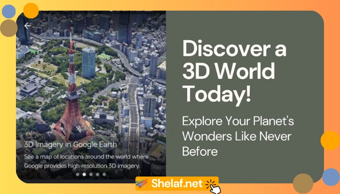
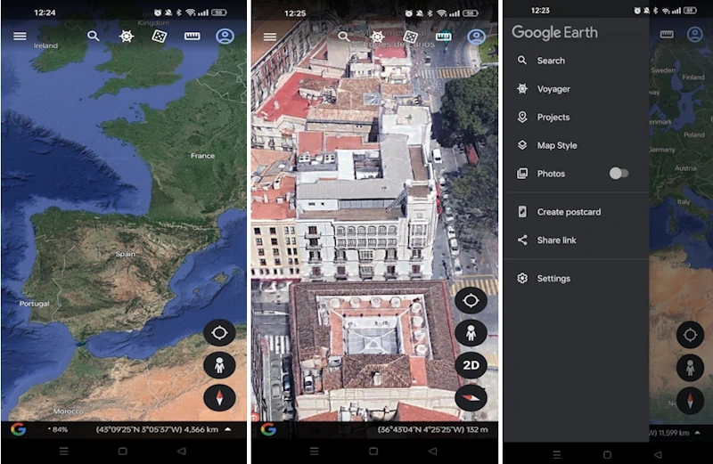
- 3D Terrain and Buildings: Forget flat images. Google Earth renders terrain and buildings in 3D, making the experience far more immersive. You can really appreciate the scale of mountains, valleys, and cityscapes. Many major cities are meticulously modeled, creating lifelike virtual tours.
- Street View: Explore from the Ground Up: One of Google Earth’s coolest features, Street View, puts you right on the ground. Using panoramic images from specially equipped vehicles, it lets you virtually walk or drive through streets, checking out neighborhoods, landmarks, and businesses as if you were there.
Exploring the World: Core Features and How They Work
Google Earth isn’t just about looking—it’s packed with features that let you interact with and learn from the data it provides:
- Search and Navigation: Finding places is a breeze. Just type in a famous landmark, an address, or even coordinates. Navigating is just as easy—pan, zoom, tilt, and rotate the globe to your heart’s content. If mobile navigation is your thing, you might enjoy reading about Apple Maps vs. Google Maps: The Ultimate Navigation Showdown.
- Layers: Add Context and Learn More: Google Earth offers a bunch of data layers you can toggle on or off to get more information. These include:
- Borders and Labels: See countries, states, cities, and other boundaries.
- Roads: View road networks to plan routes and understand how places are connected.
- Places: Discover points of interest like restaurants, hotels, parks, and historical sites.
- Photos: See user-contributed photos for a different perspective.
- 3D Buildings: Turn on 3D models for buildings—it makes cities look even more realistic.
- Weather: Get real-time weather updates, including temperature, wind, and cloud cover.
- Ocean: Explore data about ocean depths, marine life, and underwater features.
- Voyager: Guided Tours and Learning: Voyager is where Google Earth curates its best content. You’ll find interactive stories, guided tours, and educational resources, often created with partners like National Geographic, NASA, and the BBC.
- Measurement Tools: Need to measure distances or areas? Google Earth has you covered. It’s useful for everything from planning a hike to figuring out property sizes.
- Creation Tools: Make it Your Own: You can even create your own content in Google Earth:
- Placemarks: Drop markers on specific spots and add text, images, and links.
- Paths and Polygons: Draw lines and shapes to highlight routes, areas of interest, or custom regions.
- Tours: Combine placemarks, paths, and 3D views to build guided tours you can share.
- Timelapse: See How Things Change: This is a powerful feature. Timelapse lets you view historical satellite imagery, revealing how landscapes, cities, and coastlines have changed over decades. It’s a great way to see the impact of things like urbanization and climate change.
- Flight Simulator: There’s a hidden flight simulator in Google Earth Pro. It’s pretty basic, but it’s a fun way to fly around the world virtually.
Google Earth Pro: For the Power User
While the standard Google Earth is free and accessible, Google Earth Pro is aimed at professionals in fields like real estate, construction, urban planning, and research. It offers:
- High-Resolution Printing: Export and print top-quality images for presentations and reports.
- GIS Data Import: Bring in industry-standard GIS data formats like shapefiles to overlay your geospatial info on the globe.
- Spreadsheet Import: Import addresses from spreadsheets to quickly create placemarks and see locations visually.
- Movie Maker: Create HD videos of your virtual explorations.
- Advanced Measurement Tools: Calculate areas, perimeters, and volumes in 3D.
Google Earth in Action: Real-World Uses
Google Earth’s flexibility has made it a go-to tool in many fields:
- Education: Teachers use it to bring geography, history, and social studies to life. Students can explore different cultures, environments, and historical events in a really engaging way. And if you’re curious about Google’s other educational tools, check out The Future of Google Classroom: What’s Next & What to Expect.
- Urban Planning and Development: City planners use it to visualize and analyze cityscapes, plan infrastructure, and see how development impacts the environment.
- Real Estate: Agents use it to show off properties, analyze neighborhoods, and give clients a full picture of a location.
- Environmental Science and Conservation: Scientists and conservationists rely on it to track deforestation, follow wildlife migrations, assess damage after natural disasters, and study climate change.
- Journalism and Storytelling: Journalists use it to create compelling visual stories, adding context and visual evidence to their reporting.
- Travel and Tourism: Travelers use it to plan trips, scope out destinations, and get a feel for a place before they go.
- Disaster Response: Emergency responders use it to assess damage after natural disasters, coordinate relief efforts, and plan evacuation routes.
Get the Latest Version of Google Earth
Ready to explore? Get the latest version 10.71.0.3 and experience the power of Google Earth for yourself. This update includes bug fixes, performance improvements, and the most up-to-date imagery and data.
Google Earth: Frequently Asked Questions
- Can I use Google Earth offline?Yes! Google Earth lets you download areas for offline use. This is super helpful when you’re traveling somewhere with spotty internet. On mobile, tap the menu button, then “Offline areas,” and follow the steps to select and download what you need.
- How big is the Google Earth XAPK for Android?It’s surprisingly small, around 32 MB. This means it’ll work on most devices, even those with limited storage. You can download the mobile version directly: Get the latest version, 10.71.0.3.
- Can I use Google Earth on my computer?Of course! You can use it right in your web browser. Or, download the desktop version, Google Earth Pro, for Windows, Mac, or Linux. It has more features.
- Can I see old satellite images on Google Earth?You bet! The “Historical Imagery” feature (look under the “View” menu or click the clock icon) lets you view past satellite images for many places. It’s a fascinating way to see how areas have changed over time. For mastering other cool features like this, explore these Essential Google Maps Tips and Tricks You Should Explore.
The Future of Google Earth
Google Earth is always evolving. Expect more imagery updates, refined 3D models, and new features. AI and machine learning will likely bring even more advanced analysis and visualization tools. As technology marches on, Google Earth will no doubt continue to be an essential tool for understanding our world. Keep your app updated.
Conclusion
Google Earth is much more than a digital map—it’s a window to the world. It lets us explore, learn, and understand our planet in ways that were unimaginable just a few decades ago. Whether you’re a student, a professional, or just someone who’s curious about the world, Google Earth is an incredible experience that’s both educational and awe-inspiring. So jump in, start exploring, and see the world from a fresh perspective!


